
Variability in ecohydrological boundary conditions for grasslands in TAL nature reserves (WP9)
The Terai Arc Landscape (TAL) stretches across Nepal and India, featuring diverse subtropical forests and grasslands that host rich biodiversity. Understanding the spatial distribution and dynamics of this natural vegetation is essential for effective conservation and sustainable management. A key challenge is scaling insights from local studies to a regional context. To address this, researchers from HAS Green Academy are working to map the ecohydrological boundary conditions across the TAL landscape, with a focus on natural vegetation.
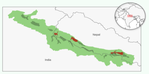
The lowlands of the Terai Arc Landscape (TAL) with the protected areas (dark green). In red the surveyed areas, from west to east: NP Shuklapanta, NP Bardia and NP Chitwan.
Between 2023 and 2024, students from the HAS Green Academy surveyed nearly 200 plots in three national parks — Shuklaphanta, Bardiya, and Chitwan — recording species compositions and measuring key features like tree height, canopy cover, and the density of understory plants. Multivariate analyses, using clustering and ordination methods, were carried out to identify and classify vegetation types and to examine the relationships between floristic composition and structural characteristics. Results revealed distinct types of forests and grasslands, though with considerable overlap in characteristic species. This overlap, particularly notable in grasslands and forest understory, suggests that there is a complex interplay between natural processes and human influences such as controlled burning.
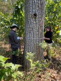
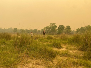
In 2025, we continued fieldworks in collaboration with NTNC in Chitwan, Bardiya, and Shuklaphanta National Parks following the standardized vegetation sampling protocol of Heide et al. (2023). On 139 detailed vegetation plots, we recorded species composition, vegetation structure, and soil moisture. To complement these in-depth surveys, 85 rapid assessments were carried out, capturing a wider range of habitats. Together, these sites were strategically chosen to cover the major vegetation types and to trace gradients running perpendicular to river channels, where ecological transitions are most pronounced.
To ensure continuity and comparability with past efforts, we compiled a harmonized dataset combining fieldwork from 2023 to 2025. This dataset contains 305 systematically sampled vegetation plots and 95 quick-scan sites, representing 5,193 unique plant observations. This integrated dataset now allows for cross-region comparisons and more robust testing of classification and monitoring approaches.
We keep combining field observations with satellite imagery and ensemble modeling to create vegetation maps covering the three surveyed nature reserves. High-resolution satellite imagery, such as from Sentinel-2, provided detailed spatial and temporal coverage, while ensemble modelling, which combines predictions from multiple algorithms (e.g., Random Forest, Gradient Boosting, and Support Vector Machines), provided a robust framework for classification. While this approach proved successful in well-studied areas like western Bardiya, applying it to other regions remains challenging.
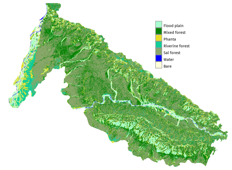
Our research focuses on improving these models by incorporating structural features of the vegetation. This approach is promising for forests, where characteristics like tree height strongly relate to species composition. However, grassland patterns have proven more complex, with both species composition and structural characteristics varying over relatively short distances. This raises critical questions about the drivers of variability: Are they small-scale soil and hydrological conditions, or are human activities like fire the primary influence?
Multivariate analyses (classification and ordination) are ongoing, with models being tested on the individual national parks as well as pooled data. Preliminary results are consistent with earlier findings: forests can be divided into three to four distinct types, while grassland and understory communities remain weakly defined, showing strong local variation and overlap of indicator species. This underlines the combined influence of natural disturbances and human pressures on vegetation patterns. Ordination analysis (constrained and non-constrained) suggests a clear link between vegetation structure and species composition for the three main forest types.
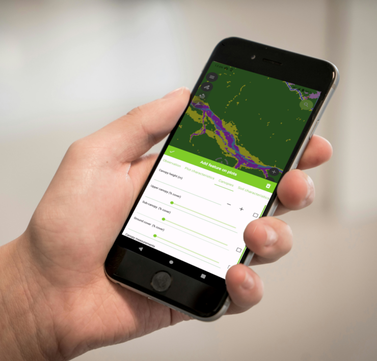
These results suggest that shifts in forest vegetation can be effectively monitored through structural metrics. However, more work is required to test how well remote sensing based indices represent vegetation structure measured on the ground. For grasslands, results are inclusive. The classification outcomes and species distribution data are used to train algorithms for the development of vegetation and species distribution maps using remote sensing imagery. Early results show that classification of the major forest types is fairly robust across sites.
Looking ahead, our work will continue the classification and modelling of vegetation distribution maps, with an emphasis on increasing both accuracy and applicability. This includes the testing of more sophisticated machine learning algorithms and ensemble approaches, which are better suited to handling the high spatial variability in vegetation and environmental factors across the TAL region. At the same time, we will expand the use of high-resolution remote sensing data, including PLANET imagery under the Centinela initiative and, where possible, canopy height models, to improve both spatial and temporal resolution of monitoring. This will be done for each of the three aforementioned parks, but we will also explore the thematic and spatial scales at which reliable extrapolation to other areas of the TAL may be possible. In collaboration with other work packages, we will focus on the topics of:
- Vegetation distribution and conservation futures in a changing climate: describe key differences in vegetation composition and environmental drivers across the national parks of the TAL and assess how projected climate change may alter vegetation dynamics, with implications for conservation planning and management.
- Opportunities and challenges in monitoring key vegetation changes through integrated surveys and remote sensing: evaluation of the strengths and limitations of combining ground-based vegetation surveys with satellite-based monitoring, highlighting lessons learned from our work in the TAL. Important thereby is not only on what can be monitored, but on which information is most valuable for nature conservation management and policy development.
WP9 team will keep close work with other working packages to integrate the findings on regional ecohydrological patterns with locally obtained data on ecohydrological dynamics, habitat quality, and wildlife distribution. This integrated approach aims to provide critical knowledge to inform conservation planning and sustainable land use decisions across the TAL region.