Hydrology of the mountainous Karnali catchment under climate and land use changes (WP3)
Installation of Meteorological Stations
Along the North-South transect of the catchment, we established several monitoring stations in Fall 2022, making significant strides in data collection. Three weather stations were installed, each equipped to measure 12 weather variables. The data is stored directly in the cloud for real-time access and analysis, ensuring that researchers can monitor climatic trends seamlessly. Additionally, two rain gauges, complemented by soil moisture sensors were deployed. The monitoring was finished in Fall 2024.
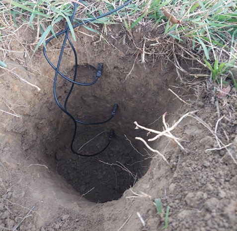
Figure 1: Soil moisture sensors at different depth in the soil
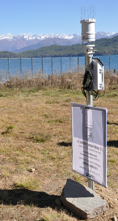
Figure 2: Weather station at 2980 m altitude
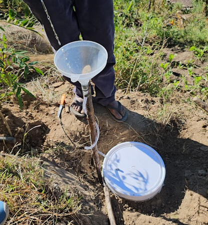
Figure 3: Setup for collection of rainwater in the Karnali catchment
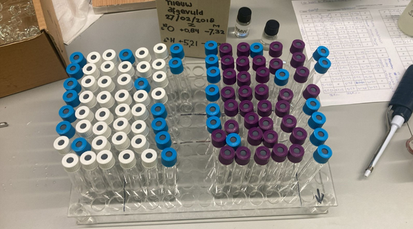
Figure 4: Collected samples from Karnali during spring 2024 ready to be analyzed in the lab
Hydrological modelling
We use a fully distributed hydrological model, the Spatial Processes in Hydrology model (SPHY), to simulate hydrological processes in the Karnali basin. The model was run for the period 1991-2022 and calibrated and validated using observed discharge data. The results show that SPHY successfully reproduced the hydrological behavior of the catchment, providing a reliable basis for analyzing spatial and temporal variations in water-balance components across the upstream Karnali basin.
Using the calibrated model outputs, we examined how key water-balance components vary spatially within the basin. We also analyzed discharge anomalies and investigated past extreme conditions by computing both meteorological and hydrological drought indices. The results revealed a strong relationship between meteorological and hydrological droughts in the region. To further understand the role of snow storage in drought buffering, we selected two major dry periods as case studies. These analyses showed that snow storage can act as an important buffer by sustaining streamflow during prolonged dry periods for approximately four to five months.
To explore the memory effects of the hydrological system, we simulated the model by changing the initial conditions of the key variables including soil moisture, groundwater storage, snow storage, meteorological inputs, and baseflow. Preliminary findings suggest that while snow storage provides important short- to medium-term buffering, meteorological conditions remain the dominant and most persistent drivers of streamflow variability. These analyses formed the basis of the first paper, which has now been published (DOI: https://doi.org/10.3389/frwa.2025.1720178).
For the second paper, we used climatological data from the ISIMIP3b dataset to investigate the impact of future climate change on the Karnali basin. The calibrated SPHY model was forced with projections from five Global Climate Models under three emission scenarios: SSP1-2.6 (low emission of greenhouse gases in the future), SSP3-7.0 (high emission), and SSP5-8.5 (very high emission with fossil-fueled development. The result focuses on how the important water balance components is affected in future under each scenario. The study analyses the changes along the elevation gradient of the basin and not only on the outlets to better understand the spatial redistribution of water balance components under climate change in the Karnali basin across different elevation zones.
Given the Karnali catchment’s vulnerability to extreme weather events, our model will keep focusing on analyzing and forecasting these critical occurrences, providing valuable insights for both conservation efforts and local communities.
In parallel, we will also focus on designing land use change scenarios to assess how shifts in land cover and management practices may influence hydrological processes in the basin. The reliability and usefulness of this component of the study will largely depend on how accurately we can represent future land use dynamics.
Water Sampling Campaign
In October 2023, we initiated a comprehensive water-sampling campaign, which continued until autumn 2024. Samples were collected from multiple water sources, including rivers, rainfall, and springs, across different locations in the Karnali basin. The main objective was to analyze the isotopic composition of these samples, primarily water isotopes, to identify the relative contributions of different water sources to streamflow and to support the validation of our hydrological model results.
We established five river-water sampling sites and three rainfall sampling sites across the mountainous Karnali catchment, extending downstream to Chisapani. In addition, spring water samples were collected to broaden the scope of the analysis. Samples from river tributaries and rainfall locations were analyzed to determine how different hydrological components and elevation zones contribute to the Karnali River at different times of the year.
Laboratory analysis was completed in autumn 2025, and the isotope results are expected to provide important signals about water origin and flow pathways within the basin. These results will be used to strengthen the model based evaluation by helping to distinguish whether river water is primarily derived from rainfall runoff at lower elevations, snow and glacier melt from higher elevations, or other contributing sources such as groundwater and springs.