
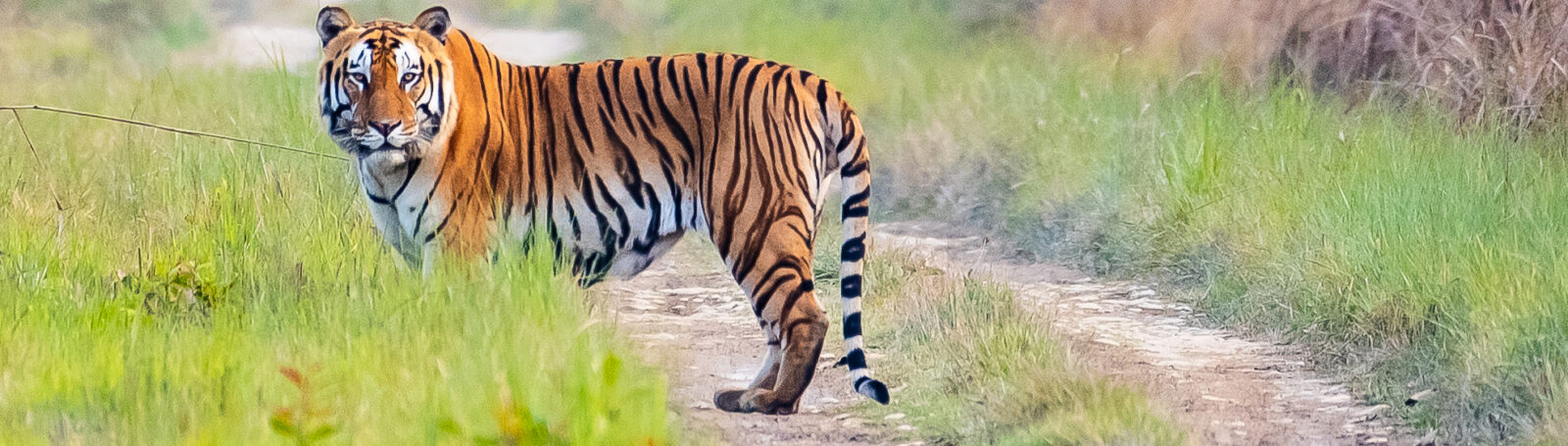
Ecohydrology of the Karnali megafan (Nepal) as related to the conservation of the tiger habitat in Bardia National Park (WP6)
The objective of Work Package 6 is to establish the spatio-temporal relationship between groundwater and surface water of the Karnali megafan and associated Bardia National Park. To be able to answer questions related to hydrological controls on natural functioning of the grasslands, we require data on aquifer system, groundwater and surface water levels, precipitation and vegetation dynamics. Hence, the work package also looks at establishing cooperation with other work packages such as 4, 5, 7, and 9.
Since October 2022, we have undertaken three fieldwork campaigns that focused on data collection. We have established cooperation with local partners such as National Trust for Nature Conservation (NTNC), International Maize and Wheat Improvement Center (CIMMYT), Nepalese laboratories and local workers to conduct our fieldwork campaigns.
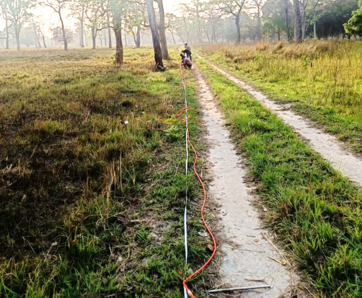
Figure 1: Geophysical survey in the national park
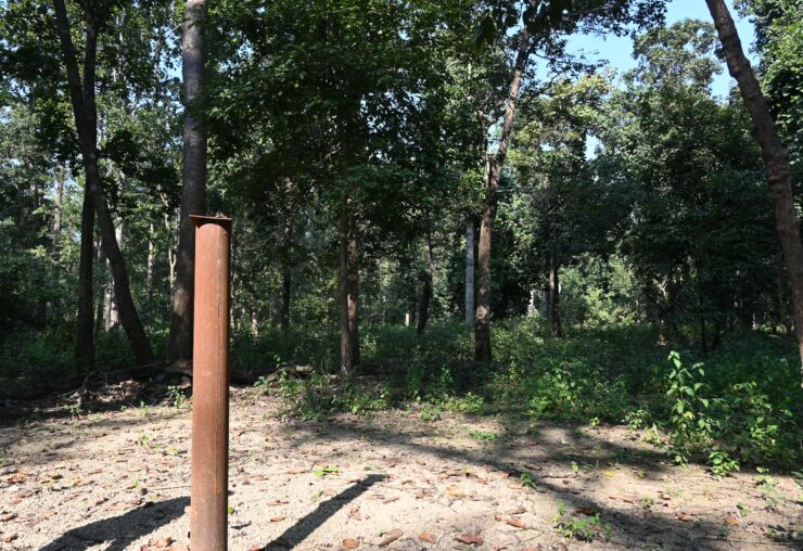
Figure 2: Groundwater monitoring well installed in the national park
Our current research seeks to generate insights on the hydrogeology of the Karnali fluvial fan. Therefore, we used Electrical Resistivity Tomography to lithologically schematize the megafan. The geophysical fieldwork campaign was conducted during April-May 2023 in collaboration with Tribhuvan University. Data was collected from 21 sites. Using inverse modelling and adding information from adjacent borewell descriptions, we delineated subsurface lithological layers of Karnali megafan and its surroundings up to a depth of 100 m. The fan apex is found to have coarse sand and gravel layers in the subsurface while to the south fine to coarse sand layers are present. Near the Babai River to the east of the fan, a sand aquifer with silt and clay pockets exists.
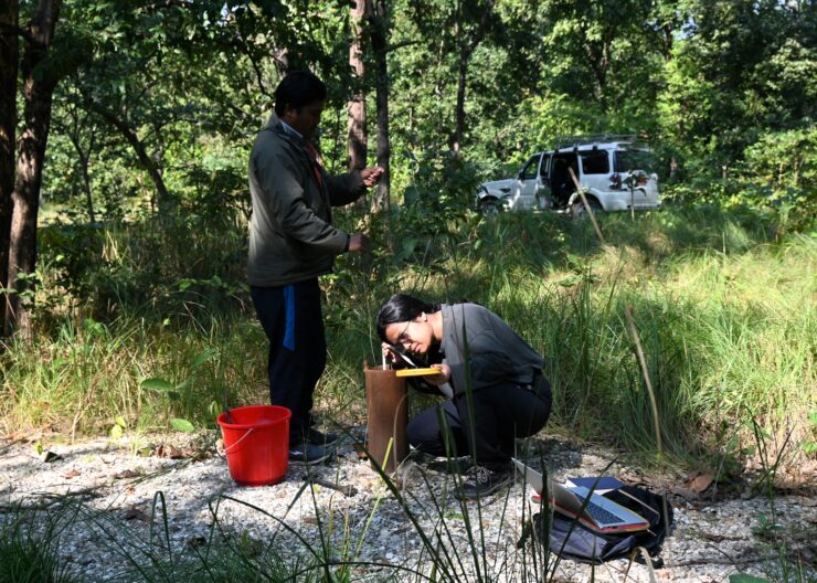
Figure 3: Measuring groundwater inside the national park
For the delineated aquifer, we have installed 18 wells to monitor groundwater levels at locations both inside and around the park. Data is being collected during field visits along with technicians from NTNC. We have also conducted slug tests to get information about aquifer parameters like hydraulic conductivity. We are using this information to construct a numerical groundwater model to simulate groundwater levels, rain recharge, as well as surface water – groundwater interactions of the fluvial fan and the park.
Recently the work focused on modelling the hydrogeology of the Karnali fluvial fan. A 3D model was developed, integrating electrical resistivity tomography (ERT) data, borehole lithology, and regional geophysical studies. We delineated five hydrogeological classes, comprising four aquifers and one aquitard within the subsurface. The insight on the aquifer system is relevant as groundwater steers the ecohydrology of the Bardia National Park, supporting its grassland ecosystems and associated wildlife habitats.
With a fieldwork campaign in February 2025, data such as soil samples, diurnal variance of stomatal conductance, plot-based leaf area index were collected from 18 grasslands plots located within the park. This data will be used to study the water stress in grasslands to get insight into grassland ecohydrology. We also collected groundwater levels from divers installed in 18 wells and concluded our two years of monitoring. This data is used in time-series analysis to show spatio-temporal dynamics of groundwater in Karnali fan and Bardia National Park and the drivers that control the dynamics in groundwater levels.
Through our research we generated new insights on hydrogeology of the Karnali fluvial fan, addressing a data gap for aquifers in the Terai region. We compiled a groundwater level dataset for the fan and the park, which are crucial data sets as groundwater information is scarce for Bardia and the rest of the Terai. During the fieldwork, we engage local technicians which has helped in valuable information exchange with local guides.
We increasingly realise the essential role of the (artificial) waterholes for the wildlife and how their presence and disappearance during the dry period may stir the seasonal migration of wildlife and related human – wildlife conflicts. These insights also get discussed with NTNC staff.
Next step will focus on construction of the groundwater flow model to show spatio-temporal dynamics using our monitored groundwater head data as well as results from our research on the hydrogeology study of the Karnali fan. The soil and vegetation data was analysed in Anamol laboratory in Nepal and its results will provide insights on soil texture and moisture conditions of the unsaturated zone where grasses grow. This part of the research will focus on generating insights on ecohydrology of water stressed grasslands. We will also research on ecohydrological modelling of grassland water stress. The models will be used to make future scenarios as inspired by discussions with local and national stakeholders. This in particular holds for agricultural practice.