News
Field work in Karnali River Basin (Upper hills and mountains)
By Pranisha Pokhrel, November 2022
Karnali river catchment lies in western Nepal and covers an area of more than 40,000 km2 with many snow-fed rivers as its tributaries. A pristine river Karnali is the longest river in Nepal flowing through the mountains, hills and terai, finally joining Ganga in India. Studies have addressed the sensitivity of the Himalayan region to climate change and its impacts on the downstream hydrology of the rivers. With profound variability in the precipitation, rising temperature, extreme precipitation events and droughts, this study aims to access the impacts of climate change and land-use change on the water availability of the basin at Chisapani floodplain.
In this work package, we aim to find out new hydrological insights for the Karnali River basin region due to climate and land use change. We seek to understand the spatial and temporal water balance and what changes have occurred during the last decade. Are these changes driven by climate or anthropogenic activities? How will the future water availability to the floodplain change and what will the main driver be? How can we adapt most effectively to these changes?
Conducting field work in Karnali River Basin offered to visit one of the most remote and diverse region of Nepal. The overall field work was about 10 days long from starting from Bardia National Park at around elevation of 160 m high up in the hills at around elevation of 2980 m amsl. The field work was filled with opportunity to study region’s hydrology, landscape and socio-economic conditions. As we were interested in monitoring the hydrological parameters, we managed to install four new stations. Two of the stations installed were manual tipping buckets and other two were ATMOS all-in-one weather stations. We also managed to connect soil moisture sensors at different depth in four of the stations. The field visit provided us visual understanding of the river basin and how the landscape and river morphology varies within the catchment.
Next step: On the next field visit, we will be visiting the installed station for downloading the data (in case of tipping buckets and soil moisture devices). We will also be checking if any replacement is also required. We are also considering to plan water sampling in upcoming field work to analyze the isotopic content. This will support our research in identifying the contributions from different sources to the flow in the river.
Acknowledgement: We would like to acknowledge mainly to our jeep driver to make this trip successful. He managed to drive on average 10 hours each day very safe on the bumpy road. We also express deep gratitude to partner NTNC, all the local supporters who helped us install stations, find suitable place and caretaker for the station.
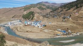
Fig. 1: Jumla Karnali as seen near Sinja Valley (Picture Credit: Jasper Griffioen,2022)
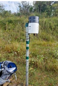
Fig. 2: Tipping bucket at Churie hills in Rajkanda village, Surkhet (Picture Credit: Pranisha Pokhrel, 2022)
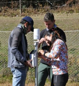
Fig. 3: Weather station at Rara National Park (Picture Credit: Jasper Griffioen, 2022)
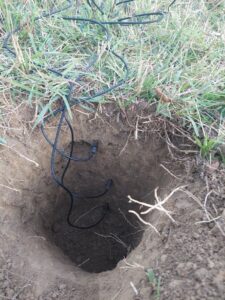
Fig. 4: Three soil moisture sensors at different depth at Rajkanda Village (Picture Credit: Pranisha Pokhrel, 2022)